

Best Hikes in Costa Rica: 15 Trails for Every Skill Level

Costa Rica is one of the best hiking destinations in Central America. Over 25% of the country is protected land, spread across 28 national parks, more than 50 wildlife refuges, and dozens of biological reserves. That means trails through cloud forests, along volcanic ridges, past turquoise waterfalls, and across wild Pacific coastline. The country holds roughly 5% of the world’s total biodiversity in an area smaller than West Virginia.
This guide covers 15 of the best hikes in Costa Rica, from easy waterfall walks that take under an hour to multi-day treks across the entire country. Each trail includes distance, elevation, difficulty, entry fees, and practical tips from local guides who hike these paths year-round.
What to Know Before Hiking in Costa Rica
Hiking in Costa Rica is not quite like hiking in North America or Europe. A few things catch visitors off guard, and knowing them ahead of time makes the experience dramatically better.
Park Entry Fees and Booking
Most hiking trails in Costa Rica sit inside national parks or private reserves. Unlike many countries, entry fees for foreign visitors are not cheap. Expect to pay between $12 and $18 USD per person at most national parks. Some parks, particularly Corcovado and Chirripó, have additional fees for permits, guides, or refugio stays that can push the total cost higher.
The critical detail: many parks now require advance booking through the SINAC (Sistema Nacional de Áreas de Conservación) website at sinac.go.cr. This is especially true for Manuel Antonio, Poás Volcano, and Chirripó, where daily visitor caps are strictly enforced. Showing up without a reservation often means getting turned away at the gate. Book at least a few days ahead during dry season (December through April), and at least two weeks ahead for Chirripó permits.
Some parks close on Mondays. Manuel Antonio is the most notable example. Always check the specific park’s schedule before planning a visit.
Do You Need a Guide to Hike in Costa Rica?
It depends on the trail. Corcovado National Park requires a certified guide by law. No exceptions. Several private reserves like the Mistico Hanging Bridges and Catarata del Toro also require or strongly encourage guided visits. Most other national parks allow self-guided hiking on marked trails.
That said, hiking with a naturalist guide dramatically increases wildlife sightings. A trained guide can spot a sleeping sloth from 50 meters away or identify a bird call that sounds like background noise to most visitors. For wildlife-rich parks like Manuel Antonio, Monteverde, and Arenal, a guide is worth the extra $15 to $50 per person even when not mandatory.
Trail Difficulty in Tropical Heat
A trail rated “moderate” in Costa Rica will feel harder than the same rating in a temperate climate. Humidity regularly sits above 80%, and midday temperatures in lowland areas hit 30 to 35°C (86 to 95°F). Even relatively flat trails can feel exhausting without shade. Cloud forest hikes at higher elevations are cooler but often wetter.
Start early. Most experienced hikers in Costa Rica hit the trail between 6:00 and 7:00 AM. The wildlife is more active, the temperatures are lower, and afternoon rain showers (common in green season) are still hours away.
Best Time to Hike in Costa Rica
The best time to hike in Costa Rica is during the dry season, from December through April. Trails are less muddy, river crossings are safer, and visibility at volcanic viewpoints is generally better. January through March is peak hiking season across most regions.
That does not mean the green season (May through November) is off-limits. Trails are less crowded, prices drop significantly, and the rainforest is at its most lush and alive. Rain typically falls in short, heavy afternoon bursts, leaving mornings clear for hiking. The Caribbean coast (including Cahuita) actually has drier weather from September through October when the Pacific side is at its wettest.
Regional variation matters. The best months for each trail are noted in the individual sections below.
15 Best Hikes in Costa Rica
1. Rio Celeste Waterfall Trail, Tenorio Volcano National Park
- Area: Tenorio Volcano National Park (most visitors come from La Fortuna, about a 90-minute drive)
- Distance: 5.7 km return for the full trail; 3.2 km return to the waterfall only
- Elevation Gain: 225 m
- Difficulty: Easy to Moderate
- Time: 2 to 3 hours (full trail)
- Entry Fee: $12 USD for foreign adults
- Guide Required: No (but available for hire at the entrance)
- Best Months: January through April
Rio Celeste is the single most popular hiking trail in Costa Rica, and for good reason. The waterfall’s color is so intensely turquoise that first-time visitors often assume photos are edited. The blue is real. It comes from a natural phenomenon called Mie scattering, where volcanic minerals (aluminum silicates) suspended in the water scatter sunlight and produce that electric blue hue.
Most visitors walk the well-maintained gravel path to the waterfall viewpoint and turn back. That is a mistake. The full trail continues past the waterfall to a hanging bridge over brilliant blue water, a natural hot spring (warm, not scalding), and the Teñidero, the exact point where two clear rivers converge and the water turns blue before your eyes. It is one of the most striking natural sights in the country.
The trail is well-graded with concrete stairs leading down to the waterfall viewpoint. Handrails are in place. Beyond the waterfall, the path becomes more rustic with some rocky and rooted sections. Swimming is prohibited anywhere inside the national park. For a swim in similar blue water, ask at local hotels about nearby swimming holes outside the park boundary.
Arrive before 8:00 AM to avoid crowds. The parking area fills up quickly during peak season.
2. Manuel Antonio National Park Circuit
- Area: Manuel Antonio, Central Pacific Coast
- Distance: 6.9 km circuit (including side trails)
- Elevation Gain: 290 m
- Difficulty: Easy to Moderate
- Time: 3 to 5 hours (depending on beach stops)
- Entry Fee: $18.08 USD for foreign adults (advance booking required through SINAC)
- Guide Required: No, but highly recommended for wildlife spotting
- Best Months: December through April (closed every Monday)
Manuel Antonio is the most visited national park in Costa Rica and one of the best places in the country to see wildlife without a guide. Sloths, white-faced capuchin monkeys, iguanas, agoutis, and hundreds of bird species live within the park’s compact boundaries.
The best way to experience the park is a full circuit. Start along the Official Road Trail toward Las Gemelas, a pair of stunning small coves. From there, climb to the Mirador lookout for panoramic views of the coastline. Continue to the main beaches (Playa Manuel Antonio and Playa Espadilla Sur), then walk out to Punta Catedral, a rocky headland that was once an island. Finish with the Sloth Trail on the return to the entrance.
Paths are well-maintained throughout, mostly concrete or compact dirt. The only steep section is the climb to the Mirador. The beaches offer perfect rest stops along the way.
Online booking through SINAC is mandatory. The park limits daily visitors, and slots sell out during peak season. Arrive for the earliest entry slot to beat both the crowds and the midday heat.
3. Mistico Arenal Hanging Bridges
- Area: Arenal, La Fortuna region
- Distance: 3.2 km loop
- Elevation Gain: Minimal (rolling terrain)
- Difficulty: Easy
- Time: 1.5 to 2.5 hours
- Entry Fee: Approximately $28 USD self-guided, $48 USD with a naturalist guide (private reserve, not SINAC)
- Guide Required: No, but guide option adds significant value
- Best Months: Year-round (December through April is driest)
The Mistico Hanging Bridges offer one of the easiest and most rewarding hiking experiences in the Arenal area. The trail loops through a 250-hectare private rainforest reserve in the shadow of Arenal Volcano, crossing a series of fixed and hanging bridges that put hikers at canopy level.
The hanging bridges sway gently underfoot and offer views straight down into the forest floor and across to the treetops. Howler monkeys, toucans, coatis, and dozens of bird species are common sightings. The reserve is home to over 700 species of plants and more than 300 bird species.
This is a reservation-only experience. Book ahead, especially during dry season. One option worth considering is the night walk, a guided after-dark tour through the same trails where red-eyed tree frogs, kinkajous, and sleeping birds become visible. It is a completely different experience from the daytime walk.
The trail surface is well-maintained and suitable for visitors of most fitness levels. Closed-toe shoes are mandatory.
4. La Fortuna Waterfall
- Area: La Fortuna, Arenal region
- Distance: Approximately 1.5 km return
- Elevation Gain: 150 m (roughly 500 steps down and back up)
- Difficulty: Easy to Moderate (the stairs are the challenge)
- Time: 1 to 1.5 hours
- Entry Fee: Approximately $18 USD for foreign adults
- Guide Required: No
- Best Months: Year-round
La Fortuna Waterfall is one of the most photographed natural features in Costa Rica. The falls drop roughly 70 meters into a wide emerald pool surrounded by dense jungle. Swimming at the base is permitted and highly recommended after the walk back up.
The trail is straightforward. A well-built staircase descends through the forest canopy to the pool at the bottom. The descent takes about 15 minutes. The climb back up is the workout, especially in humidity, but rest benches are placed at regular intervals.
This hike pairs perfectly with a visit to Arenal Volcano National Park or the Mistico Hanging Bridges, both located within a short drive. Many visitors do all three in a single day.
5. Cahuita National Park (Beginner)
- Area: Cahuita, Caribbean Coast
- Distance: Up to 8 km one way (Kelly Creek entrance to Puerto Vargas)
- Elevation Gain: Essentially flat
- Difficulty: Easy
- Time: 2 to 4 hours depending on distance covered
- Entry Fee: Donation-based entry at Kelly Creek entrance; fixed fee at Puerto Vargas entrance
- Guide Required: No
- Best Months: February, March, September, October
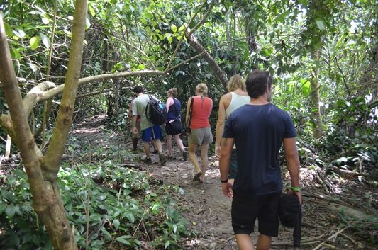
If you’re more of a relaxing walker rather than a die-hard hiker, the trails in the Cahuita National park will be just perfect for you. Tracks here are flat, well maintained, and easily accessible at any point from the Caribbean seaside.
Along the whole way you’re never more than 300 feet from a sparkling white sandy beach, so you can spend an entire day walking through thick verdant forests brimming with howler monkeys, and come out at will to splash in the refreshing sea. The months of February and March, as well as September and October, are ideal for hiking Cahuita.
Cahuita is one of only two national parks in Costa Rica that operates on a voluntary donation system at its main entrance (Kelly Creek). This makes it one of the most budget-friendly hiking experiences in the country.
The main trail runs along the coastline from Kelly Creek to Puerto Vargas, passing coral reef viewing points and some of the best snorkeling on the Caribbean coast. Howler monkeys, white-faced capuchins, sloths, and raccoons are frequent sights along the flat, shaded path.
6. Carara National Park (Short on Time)
- Area: Carara, Central Pacific (between San José and Manuel Antonio)
- Distance: 1.5 to 4.5 km depending on trail chosen
- Elevation Gain: Minimal
- Difficulty: Easy
- Time: 1 to 4 hours
- Entry Fee: $10 USD for foreign adults
- Guide Required: No, but guides are available and excellent for birdwatching
- Best Months: Year-round (less crowded in green season)
If you’re short on time and wish to find a perfect half-day excursion into nature, then the Carara National Park will be your best bet. The trails here are superbly scenic and as the park is jam-packed with exotic fauna, it also makes an ideal destination for animal lovers.
From one hour to four-hour long loop-trails, you’ll find a plethora of options here. Animals to look out for are spider monkeys, scarlet macaws, and keel-billed toucans. This is the central region’s only remaining primary rainforest and is, for very good reasons, extremely popular. You can visit at any time of year, but do make sure you beat the crowds and start your walks at first light.
Carara sits at the biological crossroads where the dry Pacific north meets the humid Pacific south. This transitional zone supports an unusually high concentration of scarlet macaws, one of the largest populations in the country.
The park’s accessibility from San José (about a 90-minute drive) and its relatively short trails make it a strong option for travelers who want a genuine rainforest hiking experience without committing to a full day. The accessible Universal Trail near the entrance is wheelchair-friendly and paved, making Carara one of the few parks in Costa Rica with genuinely inclusive trail options.
7. Poás Volcano Crater Trail
- Area: Poás Volcano National Park, Central Valley (about 1.5 hours from San José)
- Distance: Approximately 500 meters to the main crater viewpoint
- Elevation Gain: Negligible
- Difficulty: Easy (paved path, wheelchair accessible)
- Time: 30 to 45 minutes at the crater viewpoint (timed visits)
- Entry Fee: $15 USD for foreign adults (advance SINAC booking mandatory)
- Guide Required: No
- Best Months: December through April (mornings only for clear views)
Poás Volcano offers the easiest volcano hiking experience in Costa Rica. The trail from the visitor center to the main crater viewpoint is paved, flat, and takes less than 10 minutes to walk. It is suitable for visitors of all ages and mobility levels.
The crater itself is spectacular. At roughly 300 meters deep, it holds one of the world’s most acidic lakes, a milky blue-green pool that steams and occasionally sends small eruptions of gas and water into the air. On clear mornings, the views across the crater rim and into the surrounding cloud forest are breathtaking.
Timing matters enormously at Poás. The crater is frequently obscured by cloud cover, especially after 10:00 AM. For the best chance of a clear view, book the earliest entry slot available. The park uses timed entry with a maximum of roughly 74 visitors per 20-minute window. Visits are limited to approximately 30 minutes at the crater area.
The park sits at 2,708 meters above sea level. Temperatures at the summit can drop to 10°C (50°F) even on a sunny day. Bring a warm layer regardless of the weather at your hotel.
8. Monteverde Cloud Forest (Comprehensive Hiking Adventure)
- Area: Monteverde, Northwestern Highlands
- Distance: Multiple trail options ranging from 2 km to 6 km circuits
- Elevation Gain: Varies; the main reserve has rolling terrain with some moderate climbs
- Difficulty: Easy to Moderate
- Time: 2 to 5 hours depending on trail combination
- Entry Fee: Approximately $25 USD for foreign adults at Monteverde Cloud Forest Reserve; approximately $18 USD at Santa Elena Reserve
- Guide Required: No, but guided tours are the standard here and significantly improve wildlife sightings
- Best Months: January through May (drier), though cloud forest atmosphere is often best on misty days
Monteverde’s popularity comes as no surprise: this gorgeous cloud forest makes for an ideal day trip from the capital, San Jose, and offers plenty of adventure and awe-inspiring sights along with plenty of hiking trails. Zip-lines, suspension bridges and boardwalks make an outing here a truly unforgettable adventure. Experienced hikers can also get their fill, with multi-day adventures through swamps and rainforests, and past striking waterfalls, also easily accessible. The best time to hike in Monteverde in between January and May.
There are two main reserves in the Monteverde area and understanding the difference saves both money and crowds. The Monteverde Cloud Forest Reserve is the more famous and more crowded of the two.
The Santa Elena Cloud Forest Reserve, just a few kilometers away, offers a wilder and quieter experience at a lower entry price. The forest canopy at Santa Elena is so dense in places that almost no light penetrates, creating an atmosphere of total immersion.
For a recommended circuit at the main Monteverde reserve, combine the Sendero Bosque Nuboso trail with the path to La Ventana observation deck and the suspension bridge area. The trails are mostly paved and in excellent condition, a major change from the ankle-deep mud that was common here years ago.
Monteverde is one of the best places in Costa Rica (and the world) to spot the resplendent quetzal, particularly between January and May during nesting season. A naturalist guide dramatically increases the chances of a sighting.
9. Arenal National Park (Ancient Lava Flows)
 Area: Arenal, La Fortuna region
- Distance: 3 to 5.5 km depending on trail
- Elevation Gain: 100 to 210 m
- Difficulty: Easy to Moderate
- Time: 1.5 to 3 hours
- Entry Fee: $15 USD for foreign adults (SINAC)
- Guide Required: No, but guided options are available
- Best Months: January through April
 Area: Arenal, La Fortuna region
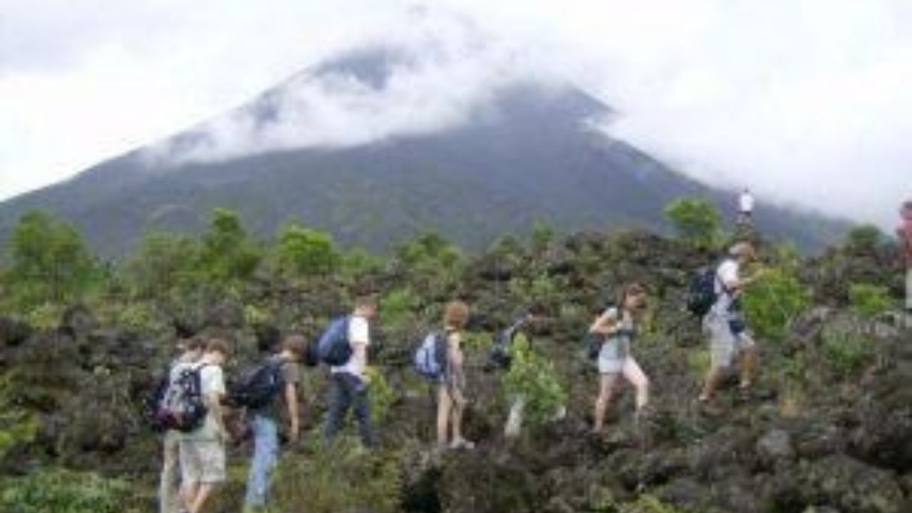
Costa Rica’s postcard destination is a phenomenal choice for walkers, hikers and even rock-climbers. The trails abound and are all very well marked and the great majority consist of relatively flat ancient lava flows.
The ever-looming Arenal Volcano will keep you company along the way, and although it has not erupted for a number of years it is still very thrilling to hike along the base of an active volcano. Some of the trails require a bit of bouldering so gather all the info you need before you head off, so you’ll know what to expect.
The variety of ecosystems in this park, which includes primary and secondary rainforest, as well as lush savannahs, makes this arguably the most rewarding hiking destination of all. Dry season here falls between January thru April.
There are multiple trail options within the national park. The 1968 Trail (named after the year of Arenal’s famous eruption) is the most popular, traversing old lava fields with panoramic views of the volcano’s cone on clear days.
The full loop is about 5.4 km with 210 meters of elevation gain. Most visitors stick to the shorter out-and-back to the main viewpoint, which means the further sections of the loop trail are often peaceful and empty.
For an alternative Arenal hiking experience with arguably better volcano views, consider the privately operated Mirador El Silencio reserve nearby.
The trail climbs through primary rainforest and emerges onto an old lava flow with a direct, unobstructed view of Arenal. It is less crowded than the national park and the entry fee is comparable.
Climbing the Arenal Volcano itself is prohibited and unsafe. The trails within the park stay at the volcano’s base.
10. Catarata del Toro
- Area: Bajos del Toro (about 2 hours from San José, 1.5 hours from La Fortuna)
- Distance: 2.7 km partial circuit
- Elevation Gain: 150 m
- Difficulty: Moderate (steep descent and ascent to the waterfall base)
- Time: 1.5 to 2 hours
- Entry Fee: Approximately $15 USD (private reserve)
- Guide Required: No
- Best Months: Year-round (green season adds mist and atmosphere)
Catarata del Toro is one of Costa Rica’s hidden gems, a waterfall that plunges roughly 90 meters straight into the crater of an extinct volcano. The spray and the sound at the base are enormous. Standing in front of it gives a genuine sense of the waterfall’s raw power.
Bajos del Toro is an emerging hiking destination that most international visitors have not yet discovered. The area sits in a cloud forest zone with mossy trees, hummingbirds, and a coolness that feels like a different country compared to the lowland heat.
Besides Catarata del Toro, the area has several other impressive waterfall hikes including the Blue Falls of Costa Rica (a series of five turquoise waterfalls in pristine rainforest) and Catarata Vuelta del Cañón (a double-drop waterfall deep in the cloud forest).
The trail to the base of Catarata del Toro is well-maintained with lookout platforms at multiple levels. The descent is steep but manageable. The final section down to the very bottom is more rustic and can be slippery. Visitors who prefer not to go all the way down will still see the waterfall from the upper viewpoints.
11. Drake Bay Trail, Osa Peninsula
- Area: Drake Bay, Osa Peninsula (Southern Pacific Coast)
- Distance: 8.5 to 11 km one way
- Elevation Gain: 150 m
- Difficulty: Moderate
- Time: 4 to 6 hours one way
- Entry Fee: None (the trail runs along the coast, not inside a national park)
- Guide Required: No
- Best Months: December through April
The Drake Bay Trail is one of the wildest coastal hikes in Costa Rica. The path follows the shoreline past a series of pristine beaches and small coves, each more remote than the last. Scarlet macaws fly overhead. Capuchin monkeys move through the canopy. The further along the trail, the fewer people.
The trail itself is mostly flat and follows decent dirt paths for the first several kilometers. Beyond Playa San Josecito, conditions become rougher and less maintained, making that beach a good turnaround point for anyone not prepared for more rugged terrain. The full one-way distance can be shortened by arranging a boat taxi back to Drake Bay from one of the further beaches.
Sun exposure is intense along the coastal sections. There is very little shade on the beach portions of the trail. Start early, carry plenty of water, and wear sun protection. The heat is the biggest challenge here, not the terrain.
The Drake Bay Trail serves as a perfect complement to a visit to Corcovado National Park, which is accessed from this same region.
12. Rincón de la Vieja National Park (A Little Remoteness)
If you wish to get away from the tourist trail yet still experience the best of Costa Rica then Rincón de la Vieja is where you should be headed. If coming from San Jose you should plan on spending at least two nights here and you’ll definitely need a 4WD rental to even reach the park.
The remoteness of this location means that you’ll find far fewer hikers here, so if it’s solitude you’re after this glorious spot will definitely tick your box. The trails at this park will guide you through an array of verdant forests, crater lakes and stunning waterfalls.
There are trails to suit all fitness levels, so whether you wish for a gentle hike or a more strenuous endeavour, you’ll find the trail that’s right for you. The months between November and April are best for this region.
Rincón de la Vieja has two sectors, and most visitors only see one. The Santa Rosa Sector (Las Pailas) is the most visited and has the famous Las Pailas loop trail, a 3.5 km easy walk past bubbling mud pots, steaming fumaroles, and volcanic hot springs. It feels like walking through a volcanic laboratory. This trail takes about 1.5 to 2 hours and is suitable for families.
The less-visited Santa Maria Sector holds one of the best-kept secrets in Costa Rica: natural hot springs in the forest, free to visitors who pay the standard park entry fee. The trail to the Santa Maria Hot Springs is about 6.4 km return, passing two small waterfalls along the way before reaching enchanting blue-tinted thermal pools shaded by the forest canopy. The trail is mostly flat dirt path through shady forest, with a few easy river crossings.
For experienced hikers, the summit trail to the crater rim of Rincón de la Vieja Volcano is an all-day affair (roughly 8 hours round trip). This hike is not suitable for children, elderly visitors, or anyone without solid hiking fitness. The reward is standing on the rim of an active volcano with views across Guanacaste and beyond.
The La Cangreja Waterfall trail (9.6 km return) is another strong option, leading to a stunning waterfall with crystal-clear swimming pools. It is one of the best trails in the park for monkey sightings.
13. Corcovado National Park – Variety
- Area: Osa Peninsula, Southern Pacific Coast
- Distance: Varies by route; La Leona to Sirena is approximately 17 km one way
- Elevation Gain: Varies; generally low (coastal trail) with some river crossings
- Difficulty: Moderate to Challenging
- Time: Full-day to multi-day depending on route
- Entry Fee: $15 USD park entry plus mandatory guide fees ($30 to $80+ depending on tour type and duration)
- Guide Required: Yes, mandatory. No exceptions.
- Best Months: December through April (trails may be closed during heaviest rains)
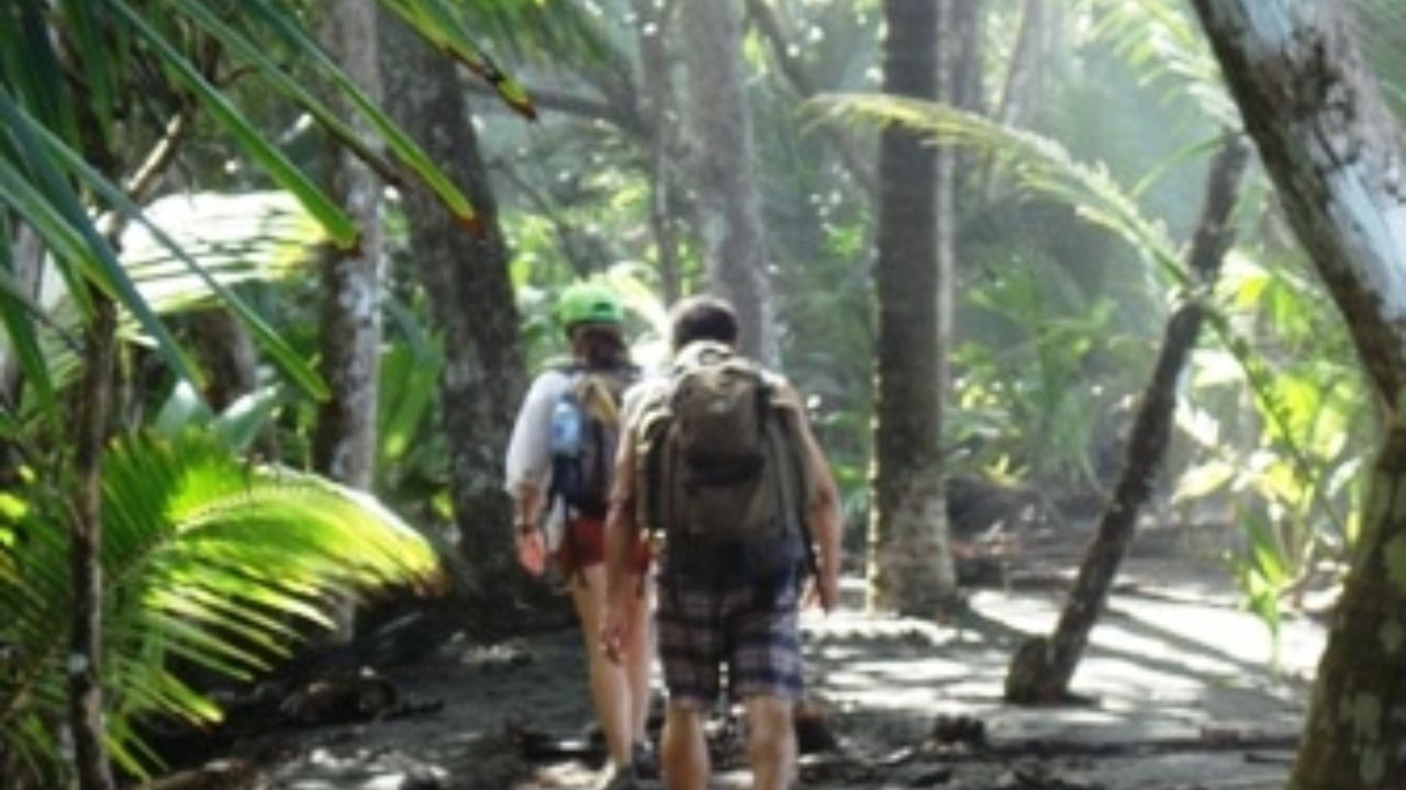 Area: Osa Peninsula, Southern Pacific Coast
One of the most visited national parks in all of Costa Rica, Corcovado boasts a dense rainforest, sandy shores and swamplands home to a plethora of fauna and flora, including a healthy population of scarlet macaws and monkeys. The fabulous thing about this park is that it offers a lot of options, thus making it suitable for beginner and experienced hikers alike.
You can choose to overnight in Drake Bay and tackle a single day hike, or shoulder a backpack full of camping gear and set off for a multi-day adventure. There are ranger stations and camping facilities allotted through the park, as well as marked trails.
Do note that multi day hikes, like the Los Patos to La Leona trail, which is a 15 mile jungle trail, can be quite strenuous and so you should be well prepared for all eventualities, most especially when visiting in the rainy season.
National Geographic once called Corcovado the most biologically intense place on Earth in terms of biodiversity. It is the largest area of primary rainforest on the American Pacific coastline and one of the few remaining significant lowland tropical rainforests in the world.
The most popular hiking route is from the La Leona Ranger Station along the coast to Sirena Station, roughly 17 km through beach, jungle, and river crossings. The final river crossing near Sirena can be waist-deep and has strong currents, particularly in green season. Guides know the safe crossing points and times.
The San Pedrillo Station, accessible from Drake Bay, is the easiest entry point and popular for day hikes. For a more immersive experience, the multi-day trek between stations with overnight stays at Sirena (bunk beds available) or camping is unmatched in Costa Rica.
Tapirs, all four Costa Rican monkey species, scarlet macaws, and (very rarely) jaguars inhabit this park. Book guided tours well in advance. Corcovado limits daily visitors to protect the ecosystem, and popular dates sell out weeks ahead.
14. Cerro Chirripó
- Area: Chirripó National Park, Talamanca Range (base town: San Gerardo de Rivas)
- Distance: Approximately 19.5 km one way to the summit
- Elevation Gain: 2,400 m from trailhead to summit
- Difficulty: Challenging
- Time: 2 to 3 days (some experienced hikers complete it in a single brutal day)
- Entry Fee: $18 USD per day for foreign adults, plus refugio (Crestones Base Camp) fees
- Guide Required: No, but permits must be booked through SINAC in advance
- Best Months: January through April
Cerro Chirripó is the highest peak in Costa Rica at 3,820 meters above sea level and the second highest in Central America. Reaching the summit is the most demanding hike in the country and one of the most rewarding.
The trail begins outside the small mountain village of San Gerardo de Rivas at about 1,350 meters elevation and climbs steadily through distinct ecological zones. Hikers pass through tropical rainforest, then cloud forest draped in moss and orchids, then a high-altitude landscape of twisted dwarf trees and open páramo grassland unlike anything else in Costa Rica. The final stretch above the treeline feels closer to the Andes than to the tropics.
Most hikers split the trek over two days, overnighting at Crestones Base Camp (a refugio at approximately 3,400 meters with bunk beds, blankets, and basic kitchen facilities). From there, the pre-dawn push to the summit takes about 2 hours.
Sunrise from the top, with views stretching to both the Caribbean Sea and the Pacific Ocean simultaneously, is considered one of the greatest experiences in Central American hiking.
Permits are limited to roughly 30 to 40 hikers per day and must be booked through SINAC. During peak season (January through March), permits can sell out weeks in advance. The trail is well-marked and does not require a guide, but the altitude, cold temperatures at night (near freezing), and physical demands make proper preparation essential.
This hike is not suitable for casual visitors. Strong fitness and appropriate gear (warm layers, headlamp, rain gear) are required.
15. Camino de Costa Rica (Coast to Coast)
- Area: Crosses the entire country from Barra de Parismina (Caribbean coast) to Quepos (Pacific coast)
- Distance: 280 km total, 16 stages
- Elevation Gain: Cumulative gain of over 10,000 m
- Difficulty: Challenging (multi-week commitment)
- Time: 16 days (minimum)
- Entry Fee: Varies by section (some stages cross national parks; others pass through private land and rural communities)
- Guide Required: Highly recommended; the trail passes through remote areas and indigenous territory
- Best Months: December through April
The Camino de Costa Rica is the country’s premier long-distance hiking route and one of the most immersive multi-day treks in Central America. Created by Conchita Espino and opened in 2018, the trail was designed to channel tourism dollars directly into the rural and indigenous communities it passes through.
The route begins at the Caribbean Sea and winds inland through Barbilla National Park, the Nairi Awari indigenous territory (home to the Cabécar people), coffee-growing highlands with rich red soil, and eventually descends to the Pacific coast town of Quepos. Along the way, hikers sleep in community homestays, small lodges, and campsites.
This is not a trail for casual hikers. Each stage averages about 17 to 18 km, and the terrain varies from dense lowland jungle to mountain passes above 3,000 meters. River crossings, mud, steep ascents, and tropical heat are all part of the experience.
For hikers who complete the full route, the Camino de Costa Rica offers something no other trail in the country can: a true cross-section of Costa Rica’s landscapes, people, and biodiversity in a single continuous journey.
What to Pack for Hiking in Costa Rica
Having the right gear makes the difference between an enjoyable hike and a miserable one in Costa Rica’s tropical climate. Here is what experienced hikers and local guides recommend for any trail in the country.
- Footwear: Closed-toe hiking shoes or boots with good tread. Many parks require closed-toe shoes and will turn away visitors in sandals. Waterproof or quick-drying options are best for green season trails. Trail runners work well for shorter, drier trails.
- Water: Carry enough for the entire planned duration. There are no water refill stations on most trails. A minimum of 2 liters per person for full-day hikes. For Chirripó, carry 3 or more liters.
- Rain protection: A lightweight rain poncho or packable rain jacket is essential year-round. Even in the dry season, afternoon showers can appear quickly, especially in cloud forest areas.
- Sun protection: Sunscreen (SPF 50+), a hat with a brim, and sunglasses. Coastal trails like Drake Bay and Cahuita have long stretches with no shade.
- Insect repellent: DEET-based or picaridin-based repellent. Mosquitoes are present in lowland and rainforest areas. Apply before entering the trail.
- Clothing: Moisture-wicking, quick-dry fabrics. Avoid cotton. Light long pants are recommended on trails with dense vegetation. For Chirripó and high-elevation cloud forest hikes, bring a warm fleece or insulating layer. Temperatures above 3,000 meters can drop near freezing.
- Other essentials: A dry bag or waterproof phone case, a small first aid kit, energy snacks, a headlamp (essential for pre-dawn Chirripó summit pushes and any Monteverde night walks), and a map or downloaded trail from AllTrails. Cell service is unreliable on most trails.
Frequently Asked Questions About Hiking in Costa Rica
Is Costa Rica Good for Hiking?
Costa Rica is one of the best hiking destinations in the world for nature-focused trails. With 28 national parks, over 50 wildlife refuges, and 12 distinct climate zones packed into a small area, the variety of hiking experiences is exceptional. Trails range from flat, paved volcano crater walks to multi-week coast-to-coast treks. The country caters to beginners and experienced trekkers equally well.
What Is the Hardest Hike in Costa Rica?
Cerro Chirripó is the most physically demanding hike in the country. The trail climbs nearly 2,400 meters over 19.5 km from the trailhead to the 3,820-meter summit. Most hikers take 2 to 3 days to complete it. The combination of distance, altitude, cold temperatures, and variable weather makes it a serious undertaking.
What Is the Most Popular Hike in Costa Rica?
Rio Celeste Waterfall in Tenorio Volcano National Park is the most popular single trail. The turquoise waterfall is one of the most iconic natural sights in the country. Manuel Antonio National Park, the Arenal Hanging Bridges, and La Fortuna Waterfall round out the top four most-visited hiking experiences.
Can You Hike in Costa Rica Without a Guide?
Most national parks and reserves in Costa Rica allow self-guided hiking on marked trails. The major exception is Corcovado National Park, where a certified guide is required by law. Several private reserves also require or strongly encourage guided visits. For wildlife spotting in any park, a naturalist guide is worth the investment.
How Much Does It Cost to Hike in Costa Rica?
National park entry fees for foreign adults range from $10 to $18 USD per park. Private reserves like the Mistico Hanging Bridges or Catarata del Toro charge $15 to $50 USD. Guided hikes cost an additional $15 to $80 depending on the duration and location. Cerro Chirripó requires daily park fees plus refugio accommodation fees. Cahuita National Park operates on a donation basis at its main entrance, making it the most budget-friendly option.
Is Costa Rica Safe for Hiking?
Costa Rica is generally safe for hikers. Trails in national parks are well-marked and maintained. The primary risks are heat-related illness (dehydration, heat exhaustion), slippery trail conditions during rain, and the occasional encounter with wildlife (snakes, though bites are extremely rare on main trails). Stick to marked paths, carry plenty of water, start early, and never hike unfamiliar trails after dark unless accompanied by a guide.
Hike Costa Rica With Expert Local Guides
Costa Rica Rios has been leading adventure tours across Costa Rica for over two decades. From guided day hikes through Corcovado’s rainforest to multi-day expeditions combining hiking with rafting, kayaking, and canyoneering, every trip is built around the country’s best trails with guides who know them inside out.
For travelers looking to experience the best hiking in Costa Rica without the guesswork of planning logistics, permits, park bookings, and transportation between trailheads, Costa Rica Rios designs custom hiking vacations tailored to any fitness level and interest.


